
Its nickname is "the Grand Canyon of the Pacific". It reminds Arizona with its rounded mountains, cliffs and shades of earth colors and evokes the grand canyon even though is definitely smaller (about ten miles long and up to 3,600 feet deep). Well, today is the great day of Waimea Canyon State Park, another jewel of Kauai Island, home of wild goats, mouffons and wild boar, just off the ocean. Formed by erosion from the Waimea River, the canyon boasts a colorful array of red, brown and green hues which are complimented by waterfalls and frequent rainbow. Wonders that only Hawaii can offer. We are driving southwest of the island, along the Waimea Canyon Drive (then Kokee road), which at some point ends. It Suddenly ends. Why? Well, the Napali Coast begins right there!

Arrivati nella cittadina di Waimea deviamo verso destra, proprio lungo la Waimea Canyon Drive e cominciamo a salire. La strada s'inerpica per una decina di chilometri buoni sino ad affacciarsi sul Waimea Canyon State Park (ingresso gratuito), dove non mancano i view point, ma anche e soprattutto le possibilità di effettuare trail più o meno faticosi. Non è facile scegliere quando e dove fermarsi per una camminata, decidiamo dunque di lasciare "la fatica" al pomeriggio, soffermandoci solamente su qualche vista point e brevissimi trail non impegnativi. Il primo che affrontiamo è anche il primo che vi troverete ad incrociare, l'Iliau Nature Loop, situato tra il miglio 8 ed il 9 (a destra). Un brevissimo loop (200 metri) ci porta per la prima volta a contatto con il Canyon, anche se le viste migliori le avremo più avanti. Ad esempio tra il miglio 9 ed il 10 (lookout), dove per la prima volta possiamo ammirare la maestosità del "Grand Canyon del Pacifico".
Once in the town of Waimea, we turn right, right along the Waimea Canyon Drive which runs along the mountains. It takes about twenty minutes to get to the Waimea Canyon State Park (no fees), where the are many view points and also the possibility to hike different trails. It is not easy to choose when and where to stop for a walk, so we start focusing only on some view point and few short trails. The first one we face is also the first one you'll run into, the Iliau Nature Loop, located between mile marker 8 and 9 (on the right). A short loop (0.2 miles) takes us or the first time close to the Canyon, although this isn't definitely the best view. A better one is, for example, located between mile marker 9 and 10 (lookout).

Siamo in territori che vivono ancora tra il mito e la leggenda, che nasce milioni di anni fa quando un violento terremoto piegò in due l'isola spianando la strada al fiume Waimea che, da quel momento, non ha mai smesso di correre prepotente all'interno del canyon. E con la Napali Coast a fare sempre da sfondo...
Those are territories which still live between the myth and the legend, which were born millions of years ago when a violent earthquake split in two the island, paving the way to the Waimea River. It started running into the canyon and it never stopped. Well, obviously there's always been the Napali Coast in the background. Isnt' this magic?

Just a couple of miles after the viewpoint, the Waimea Canyon State Park opens the door to another state park, the Kokee (no fees). Well, the name of the park is not the same, the road we are driving is not the same (Kokee Rd), but the beauty of the landscape is the same, more than 1762 hectares of forests. From here you can see the Napali coast, admire the canyon and penetrate into the tremendous humidity of Alakai's misty swamp. The KokeeIl Wood Hinaina Lookout is another good scenic spot (between mile marker 13 and 14). You can also hike the trail that leads the waterfall (2.7 miles). Anyway, we're heading to the end of the road, looking for the two most beautiful viewpoints of the whole canyon, the Kalalau Lookout, and then the Pu'u O Kila Lookout.

The Kokee Natural History Museumm located a couple of miles before the last view points, exhibits photographs, path maps, books, plant species, a wild boar trophy and a 3 kg iridescent trout. The Kalalau Lookout is the first impact with the Napali Coast, the wildest territory of the entire Hawaii. Many of the most famous movies has been filmed here, for example Jurassic Park. The waterfall of the opening scene is located into the Napali Coast, but is only reachable by plane or elichopter.

Il trail che stavamo cercando parte a ridosso del Pu'u O Kila Lookout view point. Qui la strada
s'interrompe e l'unico modo per procedere è proprio a piedi, sino al Pihea Vista Junction. Da lì potrete decidere di proseguire con il trail (che conduce al Alakai Swamp Trail) o tornare. Ogni metro vi regalerà uno scorcio diverso sulla Napali Coast. Uno più bello dell'altro.
The trail we are looking for begins at the Pu'u O Kila Lookout view point. The road ends here road and the only way to proceed is by walk till the Pihea Vista Junction. You can then decide to continue along the trail which leads to the Alakai Swamp Trail. Each part of the trail will give you a different view on the Napali Coast.


 Sulla via del ritorno e, con le idee finalmente chiare, possiamo finalmente scegliere anche quale trail percorrere all'interno del Waimea Canyon State Park. Le alternative sono due e sono gli stessi locali a confermarcelo: il Canyon trail oppure il Kukui Trail, lunghi rispettivamente 3.2 miglia e 2.5 miglia. Il più famoso è certamente il primo, che è anche il più affollato. Scegliamo dunque di percorrere il secondo. Siamo noi, una famiglia di canadesi e nessun altro, nella discesa agli inferi. Pardon, nel canyon. Il caldo si fa sentire ed il pensiero che poi dovremmo ripercorrerlo in salita ci fa desistere dall'arrivare sino al fiume, anche perchè sono gli stessi canadesi a confermarci che questa è la scelta più saggia. Di acqua giù ce n'è davvero poca... Il panorama è comunque splendido e ripaga della fatica. Il trail, cosi come il precedente, non è difficile. Soltanto faticoso...
On the way back we can finally choose the best trail to hike: it's time to get into the Waimea State Park. Even locals confirm that the best two options are the Canyon trail (3.2 miles out and back) or the Kukui Trail (2.5 miles out and back). The most famous is certainly the first one, which is also the most crowded. So let's hike the second one. It's just us, a Canadian family, and no one else, while descending into the canyon. It's very hot and even the canadian guys confirm that getting down to the river is not worth the visit. "There is really little water down there" they say. The scenery is, however, gorgeous: this is how we wanna be rewarded!

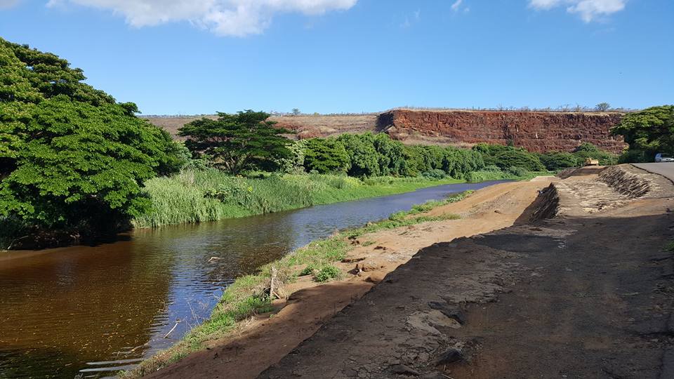 Lasciato il Canyon ci sarebbe un'altra chicca da visitare, ma la giornata è volata via in un batter di ciglio. Ma nel caso in cui aveste tempo, una volta rientrati nella città di Waimea, svoltate a destra, lungo la Kumualii hwy e percorretela interamente, sino a raggiungere una strada sterrata in mezzo alle piantagioni di zucchero, l'ultimo baluardo di civiltà (Lower Saki Marina rd). Avrete raggiunto la spiaggia più selvaggia delle intere Hawaii. Sarete all'interno del Polihale State Park, in un contesto naturale davvero incontaminato. Qui non si fa il bagno perchè le correnti sono fortissime, ma proverete quella sensazione di essere isolati. Sarete voi, dune alte anche trenta metri, ed il mare. Noi invece stiamo risalendo la costa, in direzione Hanapepe, non solo una delle città più carine di Kauai, ma anche la "casa" di Lilo nel cartone animato Lilo e Stitch. Le case del suo centro storico sono quasi tutte iscritte al "National and State Register of Historic Places" e la città pullula di gallerie d'arte. Noi siamo qui perchè vogliamo visitare uno degli "swinging bridge", ponti tipici hawaiani, in alcuni casi unico modo per passare da una sponda all'altra. Siamo all'Hanapepe Swinging Bridge, un particolarissimo ponte che attraversa il Waimea River e conduce alla fattoria situata a est del fiume.
Leaving the Canyon there's another "must visit" place, but time flies as usual and we're very late according to our schedure. If you've plenty of time just come back to Waimea, turn right along the Kumualii hwy and go all the way down till reaching a dirt road in the middle of sugar plantations, the last bastion of civilization (Lower Saki Marina rd). This is the wildest beach of all Hawaii, located into the Polihale State Park, in a truly uncontaminated natural setting. Swimming is pretty dangerous right there because currents are very strong, but you will experience the feeling of being isolated in a wild place. Even if you're in a hurry like us Hanapepe you can't certainly miss the town of Hanapepe, not just one of Kauai's finest cities, but also Lilo's "home" in the cartoon Lilo and Stitch. The houses of its old town are almost all registered at the National and State Register of Historic Places, and the city is full of art galleries. We are here because we want to visit one of the swinging bridge, a typical Hawaiian bridges, in some cases the only way to reach the other side of the river. This is the Hanapepe Swinging Bridge, a very special bridge that crosses the Waimea River and leads to the farm located east of the river.


It's sunset and the only way end the day is chilling on the beach in the beach park located within the Hawaiian Salt Ponds. The Hanapepe Salt Pond area has been used since ancient times for the production of salt for food seasoning and preservation. Every summer, the families of this region gather to build their “pans” to prepare salt for the next year. The earthen pans impart a distinct red hue and flavor to the salt. Not far from the beach park you can also visit the "Russian Fort Elizabeth", built by russians in the early 19th century. Anyway, now it's time to enjoy the ocean...

(le saline - the salt pond)

(l'oceano - the ocean)
Restare ad Hanapepe anche per cena significa spingersi fino in fondo nella cultura hawaiana. Anche a livello culinario. Paina Pono Cafè è il luogo prescelto dopo una veloce ricerca su tripadvisor. La proprietaria ci accoglie... dormendo a braccia conserte su uno dei tavoli, ma anche queste sono le hawaii, anche questo è l'aloha spirit. Non manca tanto alla chiusura, ordiniamo due piatti senza capire moltissimo di quello che ci sia scritto, ma poco importa. La cultura occidentale incontra quella orientale. Ne nascono due piatti che sono una sorta di mix. E non sono affatto male...
Staying in Hanapepe also for dinner means taste the hawaiian culture. The Paina Pono Cafe is the diner where we're going to experience the hawaiian cuisine. The owner welcomes us ... sleeping on the table: this is Hawaii and this is the aloha spirit! We don't understand very well what we've just ordered, but the two dishes are not bad at all...

FOLLOW US ON YOUTUBE:
Il Waimea Canyon nel suo splendoreFOLLOW US ON FACEBOOK:
WWW.FACEBOOK.COM/DUECUORIPERVIAGGIARE?REF=HL
CLICK ON "POST PIU' VECCHI" TO CONTINUE"
Nessun commento:
Posta un commento