Etichette

"THE BEST OF..." TOP 20! (12) 10 THINGS TO DO IN LAKE HAVASU CITY AZ (1) 10 THINGS TO SEE IN "PHILLY" (1) 3 DAYS IN PALM SPRINGS (3) 30 BEST RESTAURANTS IN USA (3) 4 BEST HIKES IN SAN DIEGO (1) 5 DAYS IN BIG ISLAND HAWAII (5) A DIFFERENT SAN FRANCISCO (1) ACQUAFRAGGIA FALLS - LOMBARDY (1) ANDALUSIA (3) ATHENS (3) BARCELONA (4) BEST ROAD TRIPS (1) BORDEAUX (2) BREMEN & HAMBURG (3) BRENT DE L'ART E GROTTE DEL CAGLIERON - LE MERAVIGLIE DEL VENETO (1) BUFFALO BILL & COWBOYS: CODY NITE RODEO - WYOMING (1) CANADA - BRITISH COLUMBIA & ALBERTA (17) COPENHAGEN (3) CUBA (4) CUMBRES & TOLTEC - THE BEST PANORAMIC TRAIN BET RUNS ALONG NEW MEXICO AND COLORADO (1) DUBLIN - JAMESON OLD DISTILLERY (1) DUBLIN GUINNESS STOREHOUSE - AN IRISH ICON (1) DURANGO & SILVERTON NARROW GAUGE TRAIN - THE TRAIN THAT MAKES YOU TRAVEL BACK IN TIME (1) FLORENCE (3) GUIDE TO NIAGARA FALLS (1) GUIDE TO THE FLORIDA KEYS (1) GUINNESS STOREHOUSE DUBLIN - AN IRISH ICON (1) HAVASU FALLS - AMERICAN PARADISE (3) ICELAND (13) ISRAEL (5) ITALY (4) JAMESON WHISKEY DISTILLERY - DUBLIN (1) LA CITE DU VIN - BORDEAUX (1) LONDON (3) LYON & ANNECY (5) MALLORCA (3) MANCHESTER (1) MARRAKECH (2) MENORCA - BEST BEACHES CITIES AND THINGS TO DO (3) MUNICH & BAVARIA (2) MUNICH & BAVARIA 2ND TIME (2) NEW YORK: LA MESSA GOSPEL (1) OUR FRIENDS EXPERIENCES (2) OUR TIPS/I SUGGERIMENTI (3) PARIS (6) PHOENIX AND TUCSON: 10 DAYS IN THE LAND OF... CACTUS (10) PROVENCE (3) ROUTE 66 - THE MOTHER ROAD (1) SEVILLA (3) SHOPPING IN THE USA: 10 BEST PLACES (1) SIGURTA' GARDENS (1) SLOVENIJA (2) TAMPA - FLORIDA'S BEST KEPT SECRET (1) THIS IS US (2) TOCCATA E FUGA (1) TOMBSTONE - ARIZONA: THE OLD WEST AS IT ONCE WAS (1) TOP 10 CHAIN RESTAURANTS IN USA (1) TORONTO - CN TOWER (1) TORONTO - SCARBOROUGH BLUFFS (1) TRENTINO ALTO ADIGE (ITALY) AND TIROL (AUSTRIA) (9) UNEXPECTED NEW YORK: HIGHLINE PARK (1) UNITED STATES - CHICAGO (5) UNITED STATES - EAST COAST (9) UNITED STATES - FLORIDA (12) UNITED STATES - THE OLD WILD SOUTHWEST (13) UNITED STATES: ARIZONA - COLORADO - UTAH (20) USA - BOSTON & CAPE COD (1) USA - EAST OR WEST? (5) USA - ITINERARY (2) USA - NEW YORK AND "THE REAL AMERICA (17) USA - SOUTH NEVADA (2) USA - TEXAS & NEW MEXICO (9) USA - THE SOUTHEAST: GEORGIA - NORTHERN FLORIDA - SOUTH CAROLINA (10) USA - WEST COAST (13) USA: KAUAI - NORTHERN CALIFORNIA - OREGON (20) USA: NEW YORK STATE - VERMONT - PENNSYLVANIA - NEW JERSEY (19) USA: ROUTE 66 - HAWAII - SEATTLE (25) USA: SOUTHERN CALIFORNIA - PALM SPRINGS AREA (3) USA: TEXAS - LOUISIANA - MISSISSIPPI - ALABAMA - TENNESSEE - ARKANSAS (20)

venerdì 27 dicembre 2019

The Hiking Trip - Arizona, Colorado and Utah (day 6: Page - Mexican Hat)

Quando si passa dalle parti di Page, Arizona, solitamente il giorno successivo ci si sposta di un paio d'ore ad est, nel cuore del territorio Navajo, per visitare il luogo che probabilmente è, insieme al Grand Canyon, quello che fa maggiormente sognare i turisti di tutto il mondo. Dove i nativi americani, la loro cultura, la loro storia e la sacralità del loro territorio, incrociano quella dei miti e delle leggende del vecchio west e dei film western hollywoodiani, dove gli spazi infiniti e le rocce sembrano disegnate dal miglior artista possibile. Tutti avrete intuito che stiamo parlando della Monument Valley, uno dei luoghi più suggestivi dell'intero pianeta. Eppure, solo 50 km prima di arrivare al Monument Valley National Tribal Park (se state provenendo da ovest), ce n'è un altro di parco, un monumento nazionale, che viene spesso e volentieri snobbato dai viaggiatori, troppo ansiosi di rincorrere il sogno chiamato Monument Valley, tra fusi orari che cambiano (ricordatevi sempre dell'ora di differenza tra Page e la Monument) ed il poco tempo a disposizione. Ma se volete davvero approcciare nel modo migliore il mondo dei nativi americani, il Navajo National Monument (ingresso gratuito) non può davvero essere escluso dal vostro programma di viaggio, soprattutto se non avete previsto una visita al Mesa Verde National Park.

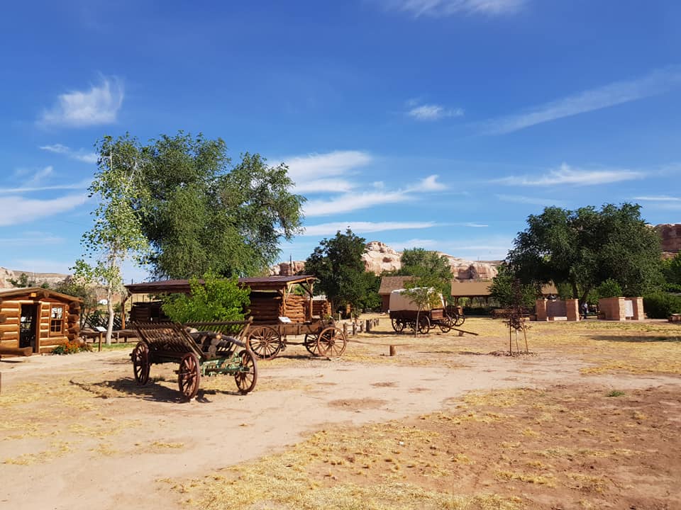
If you're visiting Page, the next day you'll move a couple of hours to the east, in the heart of the Navajo territory, to visit the place that is probably, along with the Grand Canyon, the one that makes tourists from all over the world dream. Where the Native Americans, their culture, their history and the sacredness of their territory, meet the myths and legends of the old west and Hollywood westerns movies, where infinite spaces and rocks seem to be drawn by the best artists. You've certainly guessed that we are talking about the majestic Monument Valley, one of the most evocative places on the entire planet. And yet, only 50 km before reachingthe Monument Valley National Tribal Park (if you are coming from the west), there is another park, a national monument, which is often snubbed by travelers, too eager to chase the dream called Monument Valley, between changed time zones (always remember that Page and the Monument have different time zone) and their short  time. But if you really want to approach the Native American world in the best way, the Navajo National Monument (free admission) cannot really be excluded from your travel schedule, especially if you haven't planned a visit to the Mesa Verde National Park

(Navajo National Monument)

NAVAJO NATIONAL MONUMENT - PUEBLO ANCESTRALE DEL TSEGI CANYON
Una deviazione di circa 15 miglia lungo la "564" conduce al monumento nazionale dei Navajo, istituito per preservare tre abitazioni di roccia ben conservate del Popolo Ancestrale dei Puebloan: Keet Seel, Betatakin e Inscription House, risalenti al 1300 circa avanti cristo. Il parco, poco frequentato, permette di godere nel migliori dei modi non solo delle bellezze del canyon Tsegi, ma anche di passeggiare nella quasi totale solitudine lungo i trail del monumento nazionale.

I MIGLIORI TRAIL DEL NAVAJO NATIONAL MONUMENT
Dal visitor center partono tre trail: uno dei quali permette di ammirare, seppur da lontano, le antiche abitazioni. Parliamo del Sandal Trail (0.8 miglia andata/ritorno), il trail più famoso del parco che segue un sentiero lastricato che conduce al Betetakin Cliff Dwelling. E' l'unico punto dal quale è possibile intravedere i villaggi. Gli altri due, seppure molto carini, sono immersi nella foresta del canyon. Il primo è l'Aspen Trail (0.4 miglia andata/ritorno), l'altro è il Canyon View Trail (0.8 miglia andata/ritorno) che conduce alla storica stazione dei ranger del parco.

NAVAJO NATIONAL MONUMENT - ANCHESTRAL PUEBLO OF TSEGI CANYON
A detour of about 15 miles along the "564" leads to the Navajo National Monument, established to preserve and interpret the archaeological and cultural heritage of the Ancestral Pueblo people who built Tsegi Phase villages within the natural sandstone alcoves of the canyons. Betatakin, Keet Seel, and Inscription House were occupied from approximately 1250 AD to 1300 AD and are among the best preserved cliff dwellings in the state of Arizona. The park, little frequented, allows to enjoy in the best way not only the beauty of the Tsegi canyon, but also to walk in the almost total solitude along the trails of this small but beautiful national monument.

THE BEST TRAILS OF THE NAVAJO NATIONAL MONUMENT
Three trails begin close to the visitor center: one of them allows you to admire the old houses, even from a distance. This trail is called Sandal Trail (0.8 miles round trip), the most famous of the park. It follows a paved path that leads to the Betetakin Cliff Dwelling. It is the only point from which it is possible to see the villages. The other two trails are immersed in the forest. The first one is the Aspen Trail (0.4 miles round trip), the other one is the Canyon View Trail (0.8 miles round trip) that leads to the historic ranger station..

(Sandal Trail - Navajo National Monument)

Per coloro i quali avessero più tempo a disposizione e vogliano vedere da vicino le abitazioni, c'è la possibilità di prendere parte alle escursioni condotte dai ranger durante il periodo estivo e che conducono al villaggio Betatakin. Il trail è lungo e faticoso (8 km andata/ritorno). E' possibile inoltre raggiungere anche Keet Steel (28 km andata/ritorno) grazie ad un'escursione ancor impegnativa che si può effettuare anche senza l'ausilio dei ranger. Il consiglio, come sempre, è di contattare il visitor center perchè gli accessi al trail sono contingentati.

For those who have more time to spend at the Navajo National Monument and want to see the houses up close, don't miss the hiking tours conducted by the rangers during the summer which lead to the Betatakin village. The trail is long and pretty strenous (8 km round trip). You could also get to Keet Steel (28 km round trip trail) thanks to an even more demanding excursion that can be done without the help of rangers. The advice, as always, is to contact the visitor center because the access to the trail is limited.

(Sandal Trail - Navajo National Monument)

GUIDA ALLA VISITA DELLA MONUMENT VALLEY
Quando avrete raggiunto Kayenta, la Monument Valley sarà sempre più vicina. Pur distante quasi 70 km dal parco, Kayenta è considerata la gate town della "Valley". Nulla di imperdibile, anzi: l'unica attrazione degna di nota è il Navajo Shadehouse Museum, un piccolo museo che racconta la vita degli indiani Navajo.

GUIDE TO THE VISIT OF THE MONUMENT VALLEY
When you reach Kayenta, it means that Monument Valley will be closer and closer. Although it's almost 70 km far from the park, Kayenta is considered the gate town of the "Valley". The only noteworthy attraction is the Navajo Shadehouse Museum, a small, but interesting exhibit and museum which tells about the Navajo way of life.

(Navajo Shadehouse Museum)

Poco più avanti invece non mancherete sicuramente il cartello che segna l'entrata nello Utah. La Monument Valley, infatti, è situata proprio a cavallo tra gli stati dell'Arizona e dello Utah ed una foto al cartello con la Monument in sottofondo è un must per ogni viaggiatore.

A little further on you won't certainly miss the Welcome to Utah sign. The Monument Valley, in fact, is located right on the border between the states of Arizona and Utah and you'll certainly want to take a picture of the sign with the Monument in the background. This is a must for every traveler.


Della Monument Valley, invece, ci sarebbe da scrivere un libro. Ma siccome molte delle informazioni su questo luogo magico le potete sostanzialmente trovare ovunque, noi ci concentriamo sul come viverla al meglio. In primis percorrendo il Wildcat trail (4 miglia in loop), l'unico vero sentiero del parco. In estate è sconsigliato (a volte addirittura vietato) percorrerlo dalle 10 alle 17 a causa del caldo.

On the other hand, there would be many things to say about the Monument Valley. Anyway, you could easily find many and many information about this magical place on the internet. We want to  focus on how to live it to the fullest. Primarily talking about the Wildcat trail (4 miles loop trail), the only trail in the park. In summer it is not recommended (sometimes even forbidden) to hike it from 10am to 5pm because of the heat.


Il Wildcat Trail è un'escursione circolare che conduce ad una delle zone più panoramiche che la Monument Valley ha da offrire. Permette agli hikers di avvicinare alcune delle rocce più famose del parco, tra cui Mitten Buttes e Merrick Butte.

The Wildcat Trail is a loop trail that leads to one of the most scenic areas of the Monument Valley. It allows hikers to approach some of the park's most famous rocks, including Mitten Buttes and Merrick Butte.


Per chi invece volesse percorrere le 17 miglia della dissestata (soprattutto nella prima parte) ma splendida scenic drive (Valley Drive), ecco i 9 imperdibili stop:

For those who want to travel the 17 miles of the rough (especially the first part) but amazing scenic drive (Valley Drive), don't miss the 9 unmissable stops:


1) The Mittens and Merrick’s Butte

I tre monoliti da sempre simbolo della Monument Valley: The East e West Mitten Buttes appaiono come delle mani ma in realtà rappresentano gli Spiriti che vegliano sulla valle. Merrick Butte e Mitchell Mesa prendono invece il nome da due esploratori che hanno trovato l’argento nel parco.

1) The Mittens and Merrick’s Butte

The three monoliths that have always been the symbol of Monument Valley: The East and West Mitten Buttes appear to be like hands but they actually represent the Spirits who watch over the valley. Merrick Butte and Mitchell Mesa are named after two explorers who found silver in the park.


2) Elephant Butte

Il nome la dice già lunga. Questa conformazione rocciosa assomiglia proprio ad un elefante.

2) Elephant Butte

The name says something. This rocky conformation looks just like an elephant.


3) Three sisters

Tre pinnacoli rappresentano una suora cattolica di fronte alle sue due allieve.

4) John Ford’s Point

Qui era di casa il regista John Ford che più volte ha immortalato nelle sue scene la Monument Valley. Con John Wayne spesso e volentieri come protagonista.

3) Three sisters

Three pinnacles represent a Catholic nun in front of her two students.

4) John Ford's Point

The director John Ford repeatedly immortalized Monument Valley in his best western movies. John Wayne was often the protagonist of that movies...


5) Camel Butte

La collinetta del cammello, con il vicino "The Hub" che per i Navajo rappresenta un fuoco al centro di un Hogan.

6) Bird Spring

Il punto migliore per ammirare le vaste dune di sabbia.

5) Camel Butte

The camel hill, with the neighbor "The Hub": it represents to the Navajo a fire in the center of a Hogan.

6) Bird Spring

The best place to admire the vast sand dunes.


7) Totem Pole

Gli indiani vedono in questa roccia la forma di un totem.

8) Artist’s Point

Il luogo... degli artisti, che qui si ritrovano per dipingere la Monument Valley da una posizione privilegiata.

9) North Window

Il punto più a nord, che regala una panoramica della valle con "vista dall'alto".

7) Totem Pole

Native Americans see in this rock the shape of a totem.

8) Artist's Point

The place ... of artists, who gather here to paint the Monument Valley from a privileged position.

9) North Window

The northernmost point, which offers a panoramic view of the valley with a "top view".


FORREST GUMP POINT, HOLLYWOOD AI PIEDI DELLA MONUMENT VALLEY
Mile marker 13, lungo la "163", la strada che dalla Monument Valley conduce a Mexican Hat. E' proprio qui, che ormai 25 anni fa che Tom Hanks, annuncia nel film Forrest Gump di esssere "un po' stanchino". Una frase celebre di un film che ha fatto la storia della televisione, pronunciata proprio a ridosso del miglio numero 13, ora diventato una mecca per i turisti di tutto il mondo.

FORREST GUMP POINT, HOLLYWOOD AT THE MONUMENT VALLEY
Mile marker 13, along the "163", the road that connects the Monument Valley and the city of Mexican Hat. It is here that, 25 years ago, Tom Hanks announced in the movie Forrest Gump that he is "pretty tired ". A movie that have made the history of television, pronounced just behind the mile marker 13, now become a mecca for tourists from all over the world.


LA VALLEY OF THE GODS, LA SORELLINA DELLA MONUMENT VALLEY
Di Mexican Hat avevamo già parlato durante la visita del 2013 (http://duecuoriperviaggiare.blogspot.com/2014/02/trip-2013-texas-and-new-mexico-part-7.html), nella quale tuttavia non avevamo percorso la panoramica strada che attraversa la splendida Valley of The Gods, la sorellina della Monument Valley. Siamo a nord della città, non lontani da un'altra chicca del luogo, il Goosenecks State Park, lungo una strada sterrata di 16 miglia che sbuca sulla UT163.

THE VALLEY OF THE GODS, MONUMENT VALLEY'S LITTLE SISTER
We already talked about Mexican Hat during the 2013 visit (http://duecuoriperviaggiare.blogspot.com/2014/02/trip-2013-texas-and-new-mexico-part-7.html): anyway during that trip we missed the panoramic road that crosses the majestic Valley of The Gods, Monument Valley's little sister. We are north of the city of Mexican Hat, not far from another gem of this area, the Goosenecks State Park, along a 16-mile dirt road that leads to the UT163.


Per raggiungerla svoltate lungo la 261 e percorretela per una decina di miglia, prima di effettuare una svolta a destra. Da qui comincia la strada panoramica (su sterrato) che attraversa l'intera Valley of The Gods prima di sbucare nuovamente sulla UT163. Una strada percorribile da tutte le vetture, ma solamente se non ha piovuto nei giorni precedenti. Qui, a differenza della Monument Valley, è possibile inoltrarsi a piedi alla scoperta delle varie formazioni rocciose, sebbene l'area non sia sorvegliata e non sono segnalati trails. Questa, tuttavia, non è l'unica differenza rispetto alla "sorella maggiore": qui, infatti, troverete pochissimi visitatori, sarete voi ed il silenzio di una terra magica.

To get there, just turn along the 261, follow it for about ten miles and then make a right turn. This is where the scenic road (a dirt road) begins. It crosses the entire Valley of The Gods before coming out again on the UT163. A road passable by all cars, but only if it has not rained in the previous days. Here, unlike Monument Valley, it is possible take a walk to discover the various rock formations, although the area is not supervised and no trails are marked. However, this is not the only difference compared to the "big sister": here, in fact, you will find very few visitors: it's just you and the silence of a magical land.


COME VISITARE LA VALLEY OF THE GODS
Nelle due orette buone che spenderete viaggiando attraverso la Valley of The Gods, non mancheranno le soste nei vari punti panoramici di una valle molto amata da chi ama l'avventura nella più totale solitudine. I migliori view point, partendo da nord, sono:

- Seven Sailors Butte, ovvero i sette marinai della Valley of the Gods

- Setting Hen Butte e Rooster Butte, due monoliti piuttosto imponenti

- Franklin Butte, la "guardia" della Valle

- Battleship Rock, una formazione rocciosa che ricorda una nave militare

- Castle Butte, il "castello" della valle

- Lady in the Baththub Butte, la sagoma rocciosa di una donna che fa un bagno in vasca, l'ultima bellezza prima di lasciare la valle.

HOW TO VISIT THE VALLEY OF THE GODS
It takes about two hour to drive through the Valley of The Gods. There are many possibe stops along a road which is perfect for who want to travel alone. The best view points, starting from the north, are:

- Seven Sailors Butte, the seven sailors from the Valley of the Gods;

- Setting Hen Butte and Rooster Butte, two rather imposing monoliths

- Franklin Butte, the "guardian" of the Valley

- Battleship Rock, a rock formation that resembles a military ship.

- Castle Butte, the "castle" of the valley

- Lady in the Baththub Butte, the rocky outline of a woman taking a bath in a tub, the last beauty before leaving the valley.


© RIPRODUZIONE RISERVATA

© COPYRIGHT - ALL RIGHTS RESERVED


FOLLOW US ON FACEBOOK: WWW.FACEBOOK.COM/DUECUORIPERVIAGGIARE?REF=HL

venerdì 20 dicembre 2019

The Hiking Trip - Arizona, Colorado and Utah (day 7: Mexican Hat - Durango)

La Monument Valley scalda il cuore di milioni di viaggiatori che, dopo averla visitata, scelgono di pernottare nel celeberrimo "The View", l'hotel che regala una splendida vista sulla valle. Per tanti è un binomio imprescindibile. Non per noi. E non per quelli che vogliono regalarsi un'esperienza diversa, che non significa necessariamente migliore, ma che di certo vi lascerà ricordi indelebili. Il Valley of the Gods è un autentico gioiellino nel mezzo del nulla, anzi nel cuore della Valley of The Gods, un bed and breakfast fuori dal tempo, gestito da una coppia di persone splendide, Gary e Claire, che vi faranno sentire come se foste a casa.

Monument Valley warms the hearts of millions of travelers who, after visiting it, choose to spend the night in the famous "The View", the hotel that offers an amazing view of the valley. For many of them it is an essential combination. Not for us. And not for those who want to treat themselves to a different experience, which does not necessarily mean better, but it will certainly gives unforgettable memories. The Valley of the Gods is a real gem in the middle of nowhere, indeed in the heart of the Valley of The Gods, a timeless bed and breakfast, run by a couple of wonderful people, Gary and Claire, who will make you feel like  at home.

(Valley of the Gods Bed & Breakfast)

Cos'ha di più rispetto al The View? Il Valley of The Gods Bed & Breakfast è situato all'inizio della strada panoramica che attraversa la Valley of The Gods. L'abitazione più vicina dista poco più di 10 miglia. Sarete solo voi, Gary e Claire e, se sarete fortunati, un paio di altri ospiti, a godervi lo spettacolo della valle davanti al portico della casa.

What's the difference here compared to The View? The Valley of The Gods Bed & Breakfast is located at the beginning of the scenic route that crosses the Valley of The Gods. The nearest house is just over 10 miles away. It's just you, Gary and Claire and, if you are lucky, a couple of other guests, to enjoy the spectacle of the valley in front of the house's porch.


La camera è stupenda, la colazione, preparata amorevolmente da Claire, è altrettanto fantastica. E sì, anche l'alba vista dalla loro abitazione non avrà prezzo. E l'assenza di wifi è un toccasana, vi "obbligherà" a vivere al meglio un'atmosfera davvero d'altri tempi.

The room is gorgeous, breakfast, lovingly prepared by Claire, is just as fantastic. And yes, even the dawn seen from their home is priceless. And the absence of wifi is a panacea, it will "oblige" you to live to the fullest a truly old-fashioned atmosphere.

(Breakfast at Valley of The Gods Bed & Breakfast)

Ecco, una notte al Valley of The Gods Bed And Breakfast non è proprio economicissima (siamo intorno ai 200 dollari, in linea con i prezzi del The View...) e non esiste la possibilità di prenotare online. Dovrete necessariamente chiamare. Ma sarà un'esperienza che difficilmente dimenticherete. Noi certamente non lo faremo.

Well, a night at the Valley of the Gods Bed And Breakfast is not really cheap (around $ 200, it is consistent with The View's prices) and there is no possibility to book online. You'll have to make a phone call. But this will be an experience that you will hardly forget. We certainly won't.

(sunrise at Valley of The Gods Bed & Breakfast)

Il Valley of The Gods Bed & Breakfast è situato in una posizione privilegiata anche per visitare, il mattino successivo, Muley Point percorrendo la Moki Dugway. E' risaputo, infatti, che il momento migliore per visitarlo è al mattino presto, quando il sole è alle spalle.

The Valley of The Gods Bed & Breakfast is also located in a privileged position if you want to visit Muley Point the next morning, along the Moki Dugway. It is well known, in fact, that the best time to visit it is early in the morning, when the sun is behind you.

(Moki Dugway)

La Moki Dugway (3 miglia, pendenza media dell'11%), che comincia proprio a ridosso del bed and breakfast, è una strada in salita, fatta di tornanti, che conduce alla Muley Point Road, un'altra strada sterrata che a sua volta vi porterà al mitico Muley Point.

The Moki Dugway (3 miles, average gradient of 11%), which starts right next to the bed and breakfast, is an uphill road, made of hairpin bends, that leads to the Muley Point Road, another dirt road that takes you to the mythical Muley Point.


Non ci sono barriere a proteggervi, ma la strada non è particolarmente impegnativa. Neppure se, come Marco, soffrite di vertigini. Piuttosto, controllate il meteo, se ha piovuto nei giorni precedenti sarà necessario guidare un 4wd.

There are no barriers to protect you, but the road is not particularly demanding. Not even if, like Marco, you are cared of heights. Rather, check the weather, if it rained in the previous days you will need to drive a 4wd.


Arrivati in cima, svoltate a sinistra lungo la Muley Point Road (5 miglia) sino al secondo ed ultimo dei view point, Muley Point appunto. La vista che si gode da qui è una delle più incredibili dell’ovest americano, capace nelle giornate di grazia del limpido cielo dell'Arizona di permettervi di scorgere in lontananza la Monument Valley.

Once at the top, turn left alonf the Muley Point Road (5 miles) till reaching the second and last view point, called Muley Point. The view enjoyed from this amazing view point is one of the most incredible in the American west: can you see Monument Valley in the distance?


Sotto di voi scorre il San Juan River e le insenature che noterete assomigliano moltissimo a quelle del vicino Goosenecks State Park. L'ingresso al view point è gratuito.

The San Juan River flows below you and the creeks that you will notice resemble very much those of the nearby Goosenecks State Park. Admission to the view point is free of charge.


BLUFF FORT HISTORIC SITE, ALLA SCOPERTA DEI PIONIERI MORMONI
Lasciata Mexican Hat, il successivo cenno di civiltà è la cittadina di Bluff (26 miglia a nord), un avamposto mormone di poco più di 300 anime. L'indirizzo che non dovrete mancare è il 550 Black Locust Ave, quello del Bluff Fort Historic Site, un museo gratuito (si accettano donazioni) che racconta la vita dei primi pionieri mormoni che arrivano in questa remota area dello stato dello Utah.

BLUFF FORT HISTORIC SITE, DISCOVERING MORMON PIONEERS
Once you leave Mexican Hat, the next nod of civilization is the town of Bluff (26 miles north), a Mormon outpost of just over 300 people. The address that you won't have to miss is 550 Black Locust Ave, that of the Bluff Fort Historic Site, a free museum (donations are accepted) that tells the life of the first Mormon pioneers who arrive in this remote area of the state of Utah.


Alla fine del 1800 arrivarono qui a Bluff dopo un viaggio che definire epico è quasi riduttivo, effettuato con mezzi di fortuna e attraverso territori non proprio ospitali.

At the end of the 1800s they arrived here in Bluff after an epi c trip is, made by any means they happened to find through areas that are not exactly hospitable.


Giunti qui fondarono la città di Bluff. Potrete vedere le loro case, i loro mezzi di trasporto e conoscere la storia di questi pionieri che cambiarono per sempre la storia dello Utah.

Once here they founded the city of Bluff. You will be able to see their homes, their means of transport and learn about the history of these pioneers who forever changed the history of Utah.


Sia il video introduttivo che tutti gli altri audio sono disponibili anche in italiano, rendendo ancor più semplice la visita.

Both the introductory video and all the other audios are also available many languages, making the visit even easier.


Ma almeno per noi, ciò che ha fatto la differenza è stato il fatto che una buona oretta è sembrato di vivere in un'altra epoca. Nella sala dedicata ai costumi, infatti, tre gentilissime signore, vi consentiranno di vestirvi con costumi d'epoca (gratuitamente) e di visitare la parte esterna del museo con indosso gli abiti di un tempo. Raramente ci siamo divertiti così tanto...

Anyway, at least for us, what made the difference was the fact that it seemed to be in another era. In the hall dedicated to costumes, in fact, three very kind ladies allow visitors you to dress in traditional period costumes (for free) and to visit the outside of the museum wearing those clothes We rarely had so much fun ...


Poco meno di un miglio ad est di Fort Bluff, non mancate di visitare lo storico Twin Rocks Trading Post (913 Navajo Twins Drive). Due enormi rocce rappresentano i "gemelli Navajo", sotto di loro troverete un ristorante ed un negozio di articoli artistici della cultura locale.

Just a mile east of Fort Bluff, be sure to visit the historic Twin Rocks Trading Post (913 Navajo Twins Drive). Two huge rocks represent the "Navajo twins", below them you will certainly notice a restaurant and a shop.


MESA VERDE NATIONAL PARK, LA "TAVOLA VERDE" DEL POPOLO ANASAZI
Da Bluff al Mesa Verde National Park vi attendono oltre cento miglia di noia. Tanto deserto, poca civiltà e nessun stop degno di rilievo. Eccezion fatta per la piccola deviazione verso il Four Corners Monument, l'unico luogo negli Usa dove quattro stati (New Mexico, Colorado, Utah e Arizona) s'incontrano in un solo punto (il racconto nel dettaglio lo trovate qui: Texas and New Mexico). Intanto abbiamo lasciato lo stato dello Utah, il terzo della spedizione, per entrare in Colorado, che è entrato di diritto tra i nostri preferiti. Il primo approccio con il "Rocky Mountains" state è proprio il Mesa Verde National Park, tra tutti i parchi nazionali dell'ovest a parer nostro uno dei meno eccitanti se non si è particolarmente appassionati di storia. Il parco è famoso per ospitare lungo i sui 211 chilometri quadrati, i resti di numerosi insediamenti costruiti dagli antichi Popoli Ancestrali, una volta denominati Anasazi.

MESA VERDE NATIONAL PARK, THE "GREEN TABLE" OF THE ANASAZI PEOPLE
Over a hundred miles of boredom await you from Bluff to the Mesa Verde National Park. So much desert, little civilization and no noteworthy stop. Except for the small detour to the Four Corners Monument, the only place in the US where four states (New Mexico, Colorado, Utah and Arizona) meet in a single point (the story can be found in detail here: Texas and New Mexico). Meanwhile, we have left the state of Utah, the third of the expedition, to enter Colorado, which has is now one of our favorites. The first approach with the "Rocky Mountains" state is the Mesa Verde National Park, which is in our opinion, among all the national parks of the west, one of the least exciting if you are not particularly passionate of history. The park is famous for hosting along its 211 square kilometers, the remains of numerous settlements built by the ancient Ancestral Peoples, once called Anasazi.


Si tratta di villaggi costruiti all'interno di rientranze della roccia, denominati cliff-dwellings. Il popolo Anasazi si stabilì in quest'area verso la metà del 500 provenendo dal Messico settentrionale. La cultura Anasazi raggiunse il suo apice tra il 1100 e il 1300; sono poche le informazioni sul loro stile di vita ma di certo si sa che praticavano riti religiosi in cantine sotterranee circolari, le kivas.

These are villages built within rock indentations, called cliff-dwellings. The Anasazi people settled in this area around the middle of the sixteenth century coming from northern Mexico. The Anasazi culture reached its peak between 1100 and 1300; there is little information on their lifestyle but we certainly know that they practiced religious rites in circular underground cellars, the kivas.


La strada che permette di accedere al parco, la State Hwy 10, sale per 24 km prima di raggiungere il  Far View Visitor Center, dove potrete acquistare i biglietti (prezzo: 5 dollari, validi per un determinato orario e luogo) per visitare attraverso escursioni guidate le tre principali "case" dei popoli anasazi: Balcony House, Long House e Cliff Palace. Le case non a pagamento sono invece Spruce Tree House e Step House.

Le visite guidate sono l’unico modo per ammirare da posizione ravvicinata le tre abitazioni:

- Cliff Palace, il complesso di cliff dwellings più grande del mondo.

- Balcony House, una camminata non semplice che prevede anche arrampicate permette di giungere davvero vicino alla House.

- Long House, L’insediamento costruito nella caverna più ampia.

The road that allows access to the park, State Hwy 10, goes up 24 km before reaching the Far View Visitor Center, where you can buy tickets (price: 5 dollars, valid for a specific time and place) to visit through excursions guided the three main "houses" of the Anasazi peoples: Balcony House, Long House and Cliff Palace. The non-paying houses are instead Spruce Tree House and Step House.

Guided tours are the only way to admire the three dwellings from close range:

- Cliff Palace, the largest cliff dwellings complex in the world.

- Balcony House, a not simple walk that also includes climbing allows you to get close to the House.

- Long House, the settlement built in the largest cave.


COME VISITARE MESA VERDE
Detto delle tre abitazioni a pagamento, torniamo all'entrata del parco, dove ad attendervi c'è la scenografica Mesa Top Ruins Road, che sale fino a 2000 metri di altitudine e regala viste sul Colorado Plateau. Qui domina il colore verde ed i numerosi overlook sono lì a testimoniare la maestosità di questi luoghi. Prima di raggiungere il già citato visitor center potrete fermarvi al Mancos Valley Overlook, al Montezuma Valley Overlook e al Park Point North Overlook, oppure percorrere le 2 miglia del Point Lookout Trail, l'unico vero percorso nella natura di Mesa Verde National Park. Dal visitor center poi, dovrete scegliere quale strada percorrere per prima. La Chapin Mesa conduce a sud, la Wetherill Mesa invece a ovest. Quella più visitata è indubbiamente la prima.

HOW TO VISIT GREEN MESA
Said of the three dwellings you can visit for a fee, let's start the entrance of the park, where the scenic Mesa Top Ruins Road, which rises up to 2000 meters above sea level and offers views of the Colorado Plateau, starts. Here the green color dominates and the numerous overlooks are there to witness the majesty of these places. Before reaching the aforementioned visitor center, you can stop at the Mancos Valley Overlook, at the Montezuma Valley Overlook and at the Park Point North Overlook, or hike the 2 miles of the Point Lookout Trail, the only true trail in the nature of Mesa Verde National Park. Then, from the visitor center, you will have to choose which way to go first. The Chapin Mesa leads south, the Wetherill Mesa to the west instead. The most visited is undoubtedly the first.


GLI STOP LUNGO LA CHAPIN MESA 
1) Far view ruins
Far View era una delle parti più densamente popolate della mesa dove potrete ammirare circa 50 villaggi in un'area di poco più di mezzo miglio. Tra cui Far View House, Pipe Shrine House, Coyote Village, Far View Reservoir, Megalithic House e Far View Tower.

THE STOPS ALONG THE CHAPIN MESA


1) Far view ruins
Far View was one of the most densely populated parts of the mesa, where you can see about 50 villages in an area of just over half a mile. Including Far View House, Pipe Shrine House, Coyote Village, Far View Reservoir, Megalithic House and Far View Tower.


2) Chapin Mesa Archeological Museum
Aperto tutto l'anno (dalle 8 alle 18:30 in estate - fino alle 17 in inverno) è uno dei musei archeologici più ricchi degli Stati Uniti. Mille anni di nativi americani raccolti in un solo luogo, tra oggetti, plastici e molto altro.

3) Spruce Tree House
Una breve escursione (non più di 10 minuti) conduce alla Spruce Tree House, una delle due "case" visibili gratuitamente. E' una delle più grandi dell'intero parco.

2) Chapin Mesa Archeological Museum

Open all year (from 8am to 6.30pm in summer - until 5pm in winter), it is one of the richest archaeological museums in the United States. A thousand years of Native Americans history gathered in one place, among objects, models and much more.


3) Spruce Tree House

A short trail (10 minutes) leads to the Spruce Tree House, one of the two "houses" visible for free. It is one of the largest in the entire park.


4) Ruins Road
Dal museo parte la Ruins Road (aperta sino al tramonto), che a sua volta si divide in due "loop" di circa 10 km ciascuna.

5) Square Tower House e Navajo Canyon view
La prima tappa del loop a ovest è Square Tower House: qui un breve sentiero di 150 mt porta al complesso di 80 stanze intorno a Square Tower, l'abitazione più alta del parco.

4) Ruins Road

The Ruins Road (open until sunset) begins right close to the museum. It then splits into two "loops" of about 10 km each.


5) Square Tower House and Navajo Canyon view

The first stop of the west loop is Square Tower House: here a short path (150 meters) leads to the complex of 80 rooms around Square Tower, the highest house in the park.


6) Sun Point View
Il Sun Point Overlook consente di ammirare dall'alto Spruce Canyon e diverse abitazioni tra cui Cliff Palace.

7) Sun Temple
Il tempio del sole in cima alla mesa, fu probabilmente luogo di cerimonie e epicentro dell'intera comunità.

8) Cliff Palace (pagamento)
Visitabile solo se avrete acquistato il biglietto, è la più grande dimora degli antichi pueblo, formata da ben 217 stanze e 23 kiva.

9) Balcony House (pagamento)
Visitabile solo se avrete acquistato il biglietto, è situata circa 2 miglia dopo aver superato Cliff Palace. Nelle visite ci si arrampica su tre ripide scale e si cammina in un tunnel.

GLI STOP LUNGO WETHERILL MESA
Lungo le 32 miglia della Wetherill Mesa non sono moltissimi gli stop, ma una volta raggiunto il termine della strada lo scenario cambia. L'unico modo per visitare l'area è attraverso un trenino gratuito che conduce a Long House (a pagamento) ed alla Step House (gratuito). Il trenino si ferma all'inizio dei vari sentieri che conducono ai diversi siti archeologici, con destinazione finale la Long House, la seconda casa più grande di Mesa Verde.

6) Sun Point View

The Sun Point Overlook allows you to admire Spruce Canyon from above and several houses including the Cliff Palace.


7) Sun Temple

The temple of the sun at the top of the mesa, was probably the site of ceremonies and epicenter of the entire community.


8) Cliff Palace (tickets required)

It can be visited only if you have bought the ticket: it is the largest residence of the ancient pueblo, consisting of 217 rooms and 23 kivas.


9) Balcony House (tickets required)

It can be visited only if you have purchased the ticket: it is located about 2 miles after passing Cliff Palace. During the visit, visitors have to climbs up three steep stairs and walks through a tunnel.

THE STOPS ALONG WETHERILL MESA
There are not so many stops along the 32 miles of the Wetherill Mesa, but once you reach the end of the road the scenario definitely changes. The only way to visit the area is through a train (free of charge) that leads to the Long House (ticket required) and to the Step House (free). The train stops at the beginning of the various paths that lead to the different archaeological sites: the final destination is the Long House, the second largest house in Mesa Verde.

(https://www.gjhikes.com)

CLICK ON "POST PIU' VECCHI" TO CONTINUE"


© RIPRODUZIONE RISERVATA

© COPYRIGHT - ALL RIGHTS RESERVED


FOLLOW US ON FACEBOOK: WWW.FACEBOOK.COM/DUECUORIPERVIAGGIARE?REF=HL

venerdì 13 dicembre 2019

The Hiking Trip - Arizona, Colorado and Utah (day 8: Durango & Silverton Narrow Gauge Railroad Train)

Il nostro amore per i treni panoramici parte da lontano, da quando nel 2013 durante il viaggio in New Mexico salimmo a bordo del Cumbres and Toltec Scenic Railroad e capimmo subito che un vero viaggio nel west americano non può prescindere da un'esperienza di questo genere. Questa volta ci siamo spinti di qualche miglia a nord, abbiamo cambiato stato ma non la magia che pervade i leggendari treni a vapore di fine '800, quelli che trasportavano ogni giorno su e giù per quei impervi territori montuosi centinaia di minatori e anche minerali (la stima dice oltre 300 milioni di dollari...), rendendo le due città collegate dalla ferrovia due dei principali avamposti del vecchio west. Durango e Silverton appunto. Siamo A Durango, Colorado, da dove ogni giorno dal 1879 parte un treno che fa sognare i visitatori di tutto il mondo, il Durango & Silverton Narrow Gauge Railroad Train...

Our love for panoramic trains comes from afar, since 2013, when we boarded the Cumbres and Toltec Scenic Railroad during the trip to New Mexico. We immediately understood that a real journey in the American cannot prescind from such an experience like this one. This time we went a few miles north, we left New Mexico for Colorado, bu we haven't lost the magic that pervades the legendary historic steam trains of the end of the 1800s, those that every day transported hundreds of miners and even minerals (it is estimated over $300 million in precious metals has been transported over this route) up and down the rugged mountain areas. making the two cities connected by rail two of the main outposts of the old west. Durango and Silverton, precisely. We are at the Durango rail station, Colorado: since 1879, a train that makes visitors from all over the world dream, departs every day. It is called the Durango & Silverton Narrow Gauge Railroad Train ...


LA STORIA DELLA FERROVIA DURANGO & SILVERTON
Dopo il boom economico di fine '800, che portò alla costruzione della ferrovia, sia Durango che Silverton ebbero tuttavia una evidente crisi economica una volta terminato l'argento. Quelle che prima erano città fiorenti, ricche di saloon e attività, rischiavano di diventare ghost town. Ed è stata proprio la ferrovia a correre in soccorso sia di Durango che di Silverton: fu capace di reinventarsi immediatamente come attrazione turistica e diventare dagli anni '60 del secolo scorso una delle attrazioni più visitate del west americano.

DURANGO & SILVERTON TRAIN HISTORY
After the economic boom at the end of 1800s, which led to the construction of the railway, both Durango and Silverton had an obvious economic crisis once the silver was over. Those that used to be flourishing cities, rich in saloons and activities, almost became ghost towns. And it was precisely the railway that rushed to the rescue of both Durango and Silverton: it was able to immediately reinvent itself as a tourist attraction and become one of the most visited attractions in the American west from the 1960s.


Grazie anche a Hollywood, che proprio dagli anni '60  cominciò a girare film western ambientati a Durango e in altre parti Colorado: tra cui il giro del mondo in 80 giorni, Butch Cassidy, Billy the Kid e molti altri. Già, qualora vi stiate domandando quale sia l'avventura più scenografica del Colorado, beh la risposta è proprio il treno panoramico Durango & Silverton.

Thanks also to Hollywood, which began to make western movies set in Durango and other Colorado areas: Around the World in 80 Days, Butch Cassidy and the Sundance Kid, The Prestige and many others. Well, if you're wondering what's the most scenic adventure in Colorado... the answer is very simple: it's the panoramic Durango & Silverton train.

(Durango Railroad Station)

TUTTO QUELLO CHE C'E' DA SAPERE SUL DURANGO & SILVERTON TRAIN
Settantadue chilometri. E' questa la distanza che ogni giorno il treno a vapore della Durango & Silverton percorre (144 considerando anche il ritorno) per collegare, oggi come allora, le due città. L'estate è il periodo di maggior affluenza, la peak season come la chiamano gli americani, ed il nostro consiglio è sempre quello di prenotare con larghissimo anticipo. E, se possibile, dedicate un po' di tempo al D&SNG Museum (ingresso gratuito), il bellissimo museo situato nella stazione di Durango, dove potrete ammirare camion, antichi, trattori, un vagone coperto, una motocicletta indiana, modellini di treni, locomotive a vapore a grandezza naturale, pullman d'epoca e una vasta gamma di treni, ovviamente. Gli orari del museo sono i seguenti: in inverno dalle 10 del mattino alle 4 del pomeriggio (chiuso la domenica), in estate dalle 7 alle 19 durante la peak season, dalle 7 alle 18 a maggio, nei primi giorni di giugno e verso la fine di ottobre.

EVERYTHING YOU NEED TO KNOW ABOUT THE DURANGO & SILVERTON TRAIN
Seventy-two kilometers. This is the distance that the Durango & Silverton narrow gauge train travels every day (144 km if you also consider the return) to connect the two cities today as then. Summer is the the peak season and our advice is always to book very widely in advance. And, if possible, spend some time at the D & SNG Museum (admission free), the beautiful museum located inside the Durango station, where you can see some antique trucks, tractors, a covered wagon, an Indian motorcycle, full size steam locomotives, vintage coaches and an extensive model trains layout. The museum hours of operation are as follows. Winter: Open 10 a.m. - 4 p.m. (closed on Sunday. Summer Train Season: Open daily 7 a.m - 7 p.m. (peak season) and 7 a.m. - 6 p.m. in May, early June and October.


In inverno, nonostante le temperature rigide (la neve è ovviamente di casa queste parti), il treno non si ferma ed il programma prevede eventi, cene, feste per gruppi, nostalgici del vecchio west ed amanti dell'avventura su una locomotiva. La più affascinante è ovviamente la corsa prevista durante il periodo natalizio, il Polar Express, un viaggio "verso il Polo Nord alla ricerca di Babbo Natale".

Trains run also in winter, despite the cold temperatures (snow is obviously at home in these parts). The schedule includes events, dinners, parties for groups, nostalgic for the old west. The most fascinating is obviously POLAR EXPRESS™ Train Ride Excursions to the North Pole which begin November 15th. The award-winning book by Chris Van Allsburg and adapted to the big screen in 2003, the story of a child's Christmas Eve journey comes alive onboard THE POLAR EXPRESS™ Train Ride. A special trip to North Pole.


Il treno impiega circa tre ore trenta per raggiungere Silverton: qui vi attende una pausa di due ore prima del rientro che può essere effettuato anche il bus. Sono diversi i "tour packages" offerti, così come le classi nelle quali è possibile viaggiare: la principale distinzione riguarda la scelta tra il pacchetto one way (sola andata), train roundtrip (andata e ritorno con il treno) e train bus combo (andata con il treno, ritorno con il bus). Quest'ultima è l'opzione più costosa. Considerate di spendere una giornata intera. Per maggiori informazioni rimandiamo al sito internet https://www.durangotrain.com/round-trip-silverton-train-tour#.XahznygzbIU

The train takes about three hours to reach Silverton: For a truly unforgettable step back in time, ride thecoal-fired, steam-powered narrow gauge train to the historic mining town of Silverton and back. Savor the 3 1/2 hour journey each way and spend 2 hours in Silverton for lunch and shopping and exploring the beautiful town You can also choose to come back to Durango by bus. There are several "tour packages" offered, as well as the classes: the first choice you'll have to make is about the "one way", the "roundtrip train" and the "Train Bus Combo". The latter is the most expensive option. Consider spending a whole day. For more information, refer to the website https://www.durangotrain.com/round-trip-silverton-train-tour#.XahznygzbIU

(2019 schedule and prices)

Quattro sono invece le classi dei vagoni: standard, deluxe, first class (che a sua volta si divide in Silver Vista, Yankee Girl, Alamosa Parlor Car, Kinght Sky e Prospector) e presidential. Per chi volesse viaggiare ancor di più nel tempo, consigliamo il Historic Narration Journey, dove le guide, vestite come al tempo della corsa all'argento, vi racconteranno ogni segreto dell'area di Durango e Silverton e della ferrovia. In questo link potrete valutarle nel dettaglio https://www.durangotrain.com/classes-service#.XacKjSgzbIU. I prezzi variano a seconda del periodo, della modalità di visita scelta ed ovviamente dalle classi.

There are four classes of service standard, deluxe, first class (which is divided into Silver Vista, Yankee Girl, Alamosa Parlor Car, Kinght Sky and Prospector) and presidential. For those wishing to travel even more back in time, we recommend the Historic Narration Journey, where guides, dressed in period clothing to match their character, will tell you every secret of the Durango and Silverton area and of the railway of course. In this link you can see them in detail https://www.durangotrain.com/classes-service#.XacKjSgzbIU

(Durango & Silverton train route)

Nel 2019 durante il periodo estivo il prezzo più basso era di 94 dollari. Un piccolo consiglio: se possibile, scegliete i posti dal n. 1 al 21, ovvero la parte destra del vagone, che regala nel viaggio di andata i panorami migliori. Noi abbiamo usufruito della Silver Vista e ci sentiamo di raccomandarla, soprattutto nel periodo estivo.

In 2019, during the peak season, the lowest rate was 94 dollars. A little tip: if possible, choose places from no. 1 to 21, or the right side of the wagon, which offers the best views on the outward journey. We made use of the Silver Vista and we recommend it.

(view from "Silver Vista")

IL TRAGITTO DEL DURANGO & SILVERTON NARROW GAUGE TRAIN
La prima ora, delle tre, di viaggio è sicuramente la meno scenografica. Il treno, che viaggia ovviamente piuttosto lentamente (ricordatevi che si passa dai 1980 metri di Durango ai 2800 di Silverton), impiega circa sessanta minuti a superare prima il centro abitato di Durango e poi le piccole cittadine a nord della città. La linea ferroviaria segue il corso del fiume Animas (lo attraverserete ben cinque volte), tra boschi e piccoli agglomerati, regalando emozioni uniche ai viaggiatori che si immergono nell'atmosfera di un tempo che fu.

THE DURANGO & SILVERTON NARROW GAUGE TRAIN'S ROUTE
The first of the three hours of travel is certainly the least scenic. The train, which obviously travels at a rather slow speed (remember Durango is located at 1980 m above the sea level, Silverton is located 2800 m above the sea level), takes about sixty minutes to pass first through the city of Durango and then through the small towns north of the city. The railway line follows the course of the Animas river (you will cross it five times), through woods and small agglomerations, giving unique emotions to travelers who immerse themselves in the atmosphere of a time gone by.


Ma da quando le pendenze si fanno più ripide, la musica cambia. Viaggerete spesso e volentieri con viste mozzafiato su fiumi, montagne e valli. Non mancheranno i punti in cui vi troverete a strapiombo sulla montagna: sarà qui, quando il treno curverà, che potrete scattare le migliori foto del viaggio.

But since the slopes get steeper, the music changes. You'll often travel with breathtaking views of rivers, mountains and valleys. Thee will be points at which you're overhanging the mountain: it's  here, when the train turns, that you will be able to take the best photos of the journey.


IL FASCINO SENZA TEMPO DI SILVERTON, COLORADO
Chi si aspetta una città fiorente, come lo era alla fine dell'800, rimarrà deluso. Silverton, il cui nome significa "argento a tonnellate", è da una parte ancora strettamente ancorata al suo passato leggendario, ma dall'altra deve tutto alla ferrovia che di fatto l'ha tenuta in vita impedendole di diventare una delle tante anonime ghost town dell'ovest americano.

SILVERTON'S TIMELESS CHARM
Those expecting a thriving city, as it was at the end of the 1800s, will be disappointed. Silverton, whose name means "tons of silver", is on the one hand still closely anchored to its legendary past, but on the other it owes everything to the railway that kept it alive by preventing it from becoming one of the many anonymous ghost towns of the American west.

(Greene Street, Silverton, Colorado)

A Silverton si conclude il viaggio del Durango & Silverton Narrow Gauge Train, in una città dove il tempo sembra davvero essersi fermato, con le montagne a fare da sfondo e gli edifici dei tempi d'oro a ricordarne il passato glorioso. La sosta di un paio d'ore prima del rientro a Durango vi permetterà di visitarla in lungo e in largo e, dobbiamo ammetterlo, a noi Silverton è piaciuta moltissimo.

The journey of the Durango & Silverton Narrow Gauge Train ends in Silverton, in a city where time really seems to stand still, with the mountains in the background and the buildings of the golden rush to remember its glorious past. The 2 hours stopover before returning to Durango will allow you to visit it far and wide and we must admit that we enjoyed Silverton!


Anche se doveste arrivarci con la propria auto, attraverso la Million Dollar Highway, è sostanzialmente impossibile perdersi. L'unica strada asfaltata che l'attraversa è Greene Street.

Even if you're getting there by car, driving along the Million Dollar Highway, it's basically impossible to get lost. There's just one paved road, Greene Street.


Il suo alter ego, Blair Street,è un autentico viaggio nel tempo (proprio come Empire Street) , tra edifici storici come la prigione e molti altri che risalgono ai tempi in cui, durante la corsa all'argento, la stessa strada era attraversata da fuorilegge e mercanti.

Its alter ego, Blair Street (as also Empire Street) is a true journey through time, between historic buildings like the prison and many others dating back to the times when, during the gold and silver rush, the same road was crossed by outlaws and merchants.

(The jail - Empire Street, Silverton)

Ai tempi della corsa all’argento, Blair Street non era proprio una via adatta a tutti: godeva, infatti, di una pessima fama a causa dei tanti bordelli che la caratterizzavano. E se Durango è sempre stata una città "di persone rispettabili" (le famiglie dei lavoratori venivano lasciate proprio a Durango), lo stesso non si può dire di Silverton. Qui i lavoratori, ma anche i fuorilegge, l'avevano resa una città del peccato. Il Natalia's Restaurant, risalente al 1912, è uno dei più famosi e fotografati edifici della città.

At the time of the gold and silver rush, Blair Street was not exactly a plsce suitable for everyone: in fact, it got a bad reputation due to the many brothels. And if Durango has always been a city of "respectable people" (workers' families were left in Durango), the same cannot be said for Silverton. Workers, but also outlaws, made Silverton a sin city. The Natalia's Restaurant, dating back to 1912, is one of the most famous and photographed buildings in town.


DURANGO, UN GIOIELLINO INCASTONATO TRA LE MONTAGNE
Sentirete spesso i visitatori di tutto il mondo parlare di una Durango "affascinante, dove val la pena non solo fermarsi ma spendere anche qualche giorno...". Nulla di più vero, Durango, incastonata tra le San Juan Mountains a circa 2000 metri di altitudine, è un autentico gioiellino, dove storia e natura si fondono rendendola una delle città più amate soprattutto dagli americani. D'altronde, se anche Hollywood non solo è passata da queste parti, ma ci è restata per un bel po', significa che Durango ha, sin dai tempi in cui saloon e pistoleri erano all'ordine del giorno, una spiccata personalità.

DURANGO, A JEWELRY SET IN THE MOUNTAINS
You will often hear visitors from all over the world tell about a "charming Durango, a special place which is still worth going and spend there few days". That's the truest thing we know. Durango, set among the San Juan Mountains at a height of 2000 meters above sea level, is a real gem, where history and nature merge making it one of the most loved cities especially by Americans. On the other hand, if Hollywood set many movies in Durango, it means that Durango has ever had a strong personality.


Il suo cuore pulsante è la lunghissima main avenue, quella che per intenderci comincia da nord, non appena si entra in città, e si conclude alla stazione dalla quale parte il treno Durango & Silverton. La parte conclusiva, quella che si affaccia sulla stazione, pullula di ristoranti, bar, negozi ma anche di edifici storici, tra cui il General Palmer Hotel e lo Strater Hotel, i due alberghi più antichi della città. A prescindere che soggiorniate o meno in questi due lussuosi hotel, val la pena entrare ed ammirarli anche dall'interno.

Its beating heart is the very long main avenue, the one that begins from the north, as soon as you enter the city, and ends at the rail station from which the Durango & Silverton train departs. The final part, the one overlooking the station, is full of restaurants, bars, shops but also of historic buildings, including the General Palmer Hotel and the Strater Hotel, the two oldest hotels in the city. Even if you're not staying in these two luxurious hotels, it is worthwhile to enter and admire them from the inside.


COSA VEDERE A DURANGO - IL BAR D CHUCKWAGON SUPPER SHOW
Ma se c'è un appuntamento che non vorrete mancare quando passerete dalle parti di Durango è quello con il Bar D Chuckwagon Supper Show. Siamo a nord della città, una decina di miglia per l'esattezza, in un'area quasi nascosta tra le montagne. Ma vi assicuriamo che il 8080 County Road 250, Durango è l'indirizzo esatto. Ad attendervi un luogo magico, aperto dal Memorial Day sino al Labor Day, un ranch che si trasforma in un luogo d'incontro per quella che noi amiamo di più, la gente del posto. Centinaia, infatti, sono quelli che arrivano qui ogni giorno dalle 17 per assistere ad uno spettacolo di country "cabarettizzato", dove 4 formidabili personaggi suonano, cantano ed intrattengono i presenti. La versione di Nella Vecchia Fattoria è clamorosamente divertente. Si può assistere gratuitamente alle loro performance, oppure cenare (a pagamento): la cena è a base di carne, ci si mette in fila con il proprio vassoio e nel giro di qualche minuto sarete lì a scambiare qualche battuta con i cowboys del posto, mentre per i più piccoli potranno divertirsi con le attività proposte dal ranch, tra cui un piccolo treno panoramico, un giro sul carro, il lancio del lazzo o la ricerca dell'oro. Se amate stare a contatto con i locali, non c'è niente di meglio che una serata spesa al mitico Bar D Chuckwagon Supper Show.

THINGS TO SEE IN DURANGO - THE BAR D CHUCKWAGON SUPPER SHOW
However, if there's a place you won't want to miss when while visiting Durango, it is definitely 's the Bar D Chuckwagon Supper Show. We are ten miles north of the city, in an area almost hidden in the mountains. But we assure you that the 8080 County Road 250, Durango, is the exact address. A magical place awaits you (it's open from Memorial Day until Labor Day), a ranch that turns into a meeting place for the people we love the most, the locals. Hundreds of people, in fact, come there every day from 5 pm to attend the "Old West Cowboy Music Show and Chuckwagon Supper". The Bar D Wranglers perform songs of old west cowboys, comedy stage shoe, and lively instrumentals after supper to entertain the whole family. The Old  MacDonalds Had a Farm's version is very, very funny. Dinner includes three kind of meals. The Regular Ticket offers a choice of sliced Roast Beef or Boneless Chicken Breast simmered in barbecue sauce, the Combo Ticket includes both Roast Beef and Chicken Breast and the Steak Ticket entree is a flame broiled Rib Eye Steak cooked in the medium range. There are also many activities and games for children, including a small panoramic train, a ride on the wagon pulled by a vintage tractor, a shooting gallery, where kids can shoot an old west style revolver and much more. If you love daling with the locals, there is nothing better than an evening spent at the legendary Bar D Chuckwagon Supper Show.


DOVE CENARE A DURANGO
Per quelli che preferiranno assistere solamente allo spettacolo del Bar D Chuckwagon Supper Show, evitando di cenare al ranch, le alternative non mancano. Ecco quelle che secondo noi sono le migliori: Carver Brewing Co (1022 Main Ave), Steamworks (801 E 2nd Ave), El Moro Spirits & Tavern (945 Main Ave), BREW Pub & Kitchen (117 W College Dr) ed infine Serious Texas Bar-B-Q (3535 North Main Avenue).

PLACES TO EAT IN DURANGO
For those who prefer to attend only the show at the Bar D Chuckwagon Supper Show and skip the dinner at the ranch, there are many alternatives. Here you can see the ones we think are the best: Carver Brewing Co (1022 Main Ave), Steamworks (801 E 2nd Ave), El Moro Spirits & Tavern (945 Main Ave), BREW Pub & Kitchen (117 W College Dr) and Serious Texas Bar-BQ (3535 North Main Avenue).


© RIPRODUZIONE RISERVATA

© COPYRIGHT - ALL RIGHTS RESERVED


FOLLOW US ON FACEBOOK: WWW.FACEBOOK.COM/DUECUORIPERVIAGGIARE?REF=HL